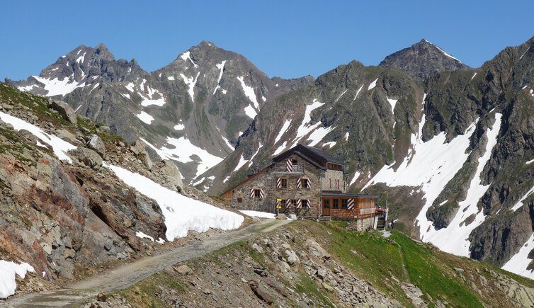
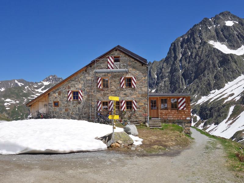
Easy but physically demanding hike from the Rendlbahn mountain station, passing by the Tritsch Alp and Lake Kartellspeicher, to the DAV Darmstadt-Starkenburg mountain hut at an altitude of 2,390 m
Image gallery: Hike to the Darmstädter Hütte mountain hut
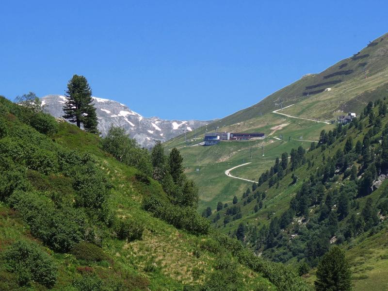
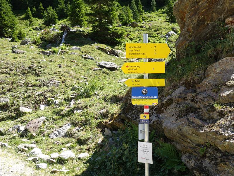
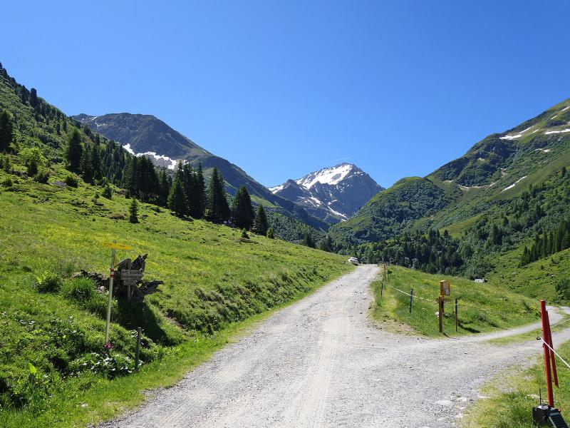

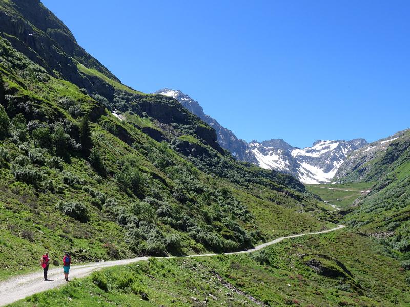
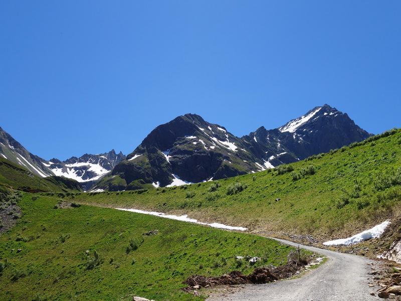
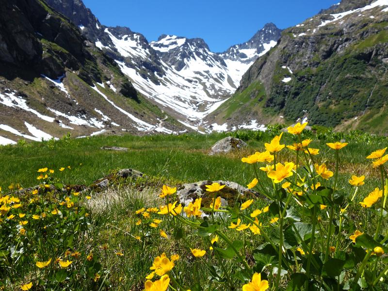
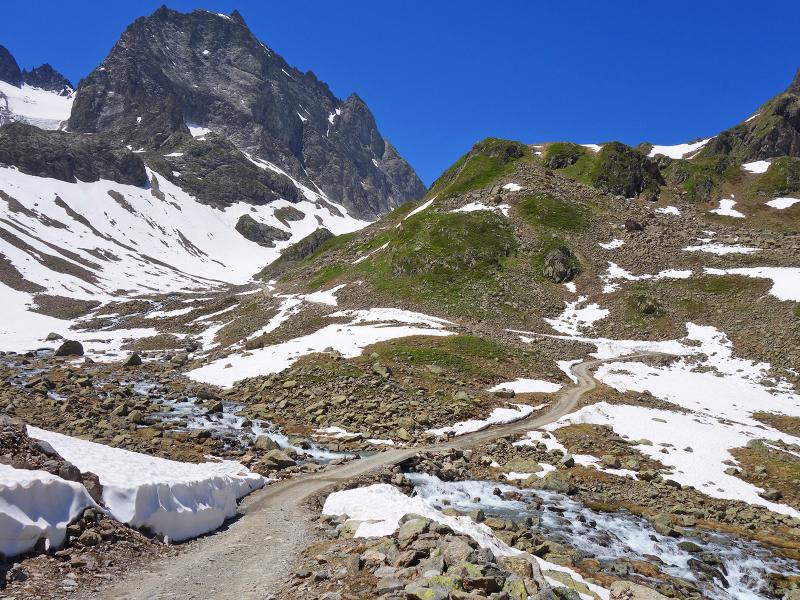

This tour leads directly into the heart of the Verwall Mountains. It will take you a whole day to walk the 9.2 km (each direction) with its 1,100 m of difference in altitude on paths with gravel surface. The ideal starting point is the Rendlbahn mountain station. This cable car starts in the centre of St. Anton am Arlberg, but during the summer months it doesn't operate daily. From the mountain station (2,020 m a.s.l.) the path leads downward to the Moostal valley (singpost "Tritsch Alpe"). There, at 1,700m, we follow the signpost "Darmstädter Hütte" until we reach our destination.
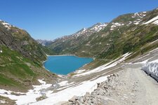
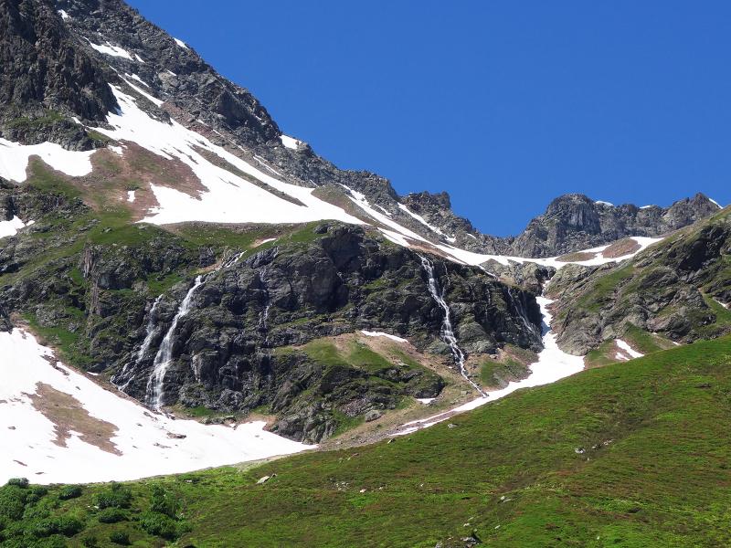
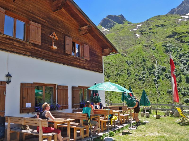
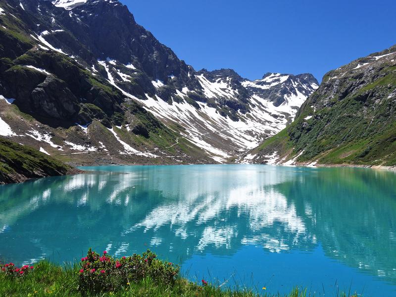
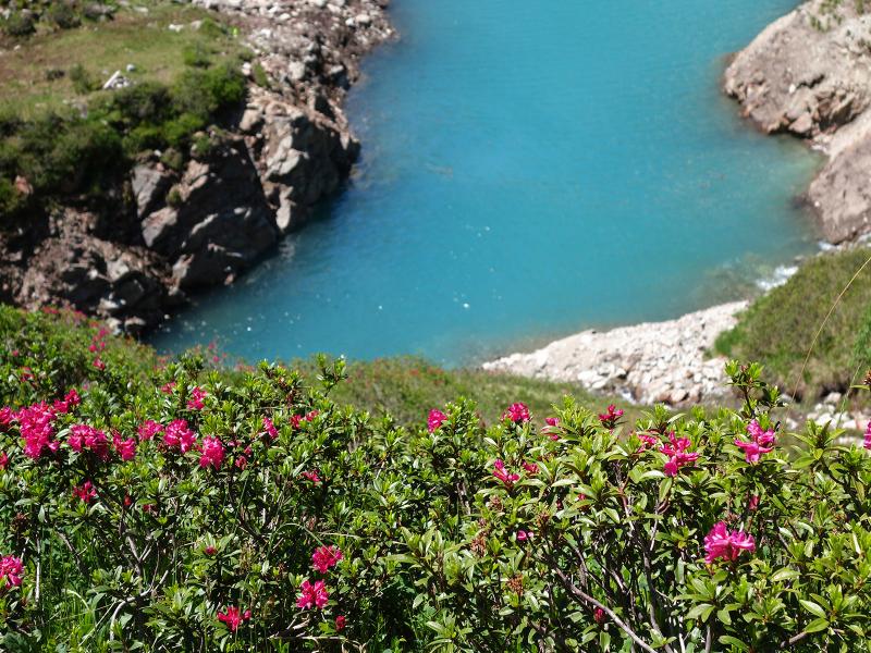
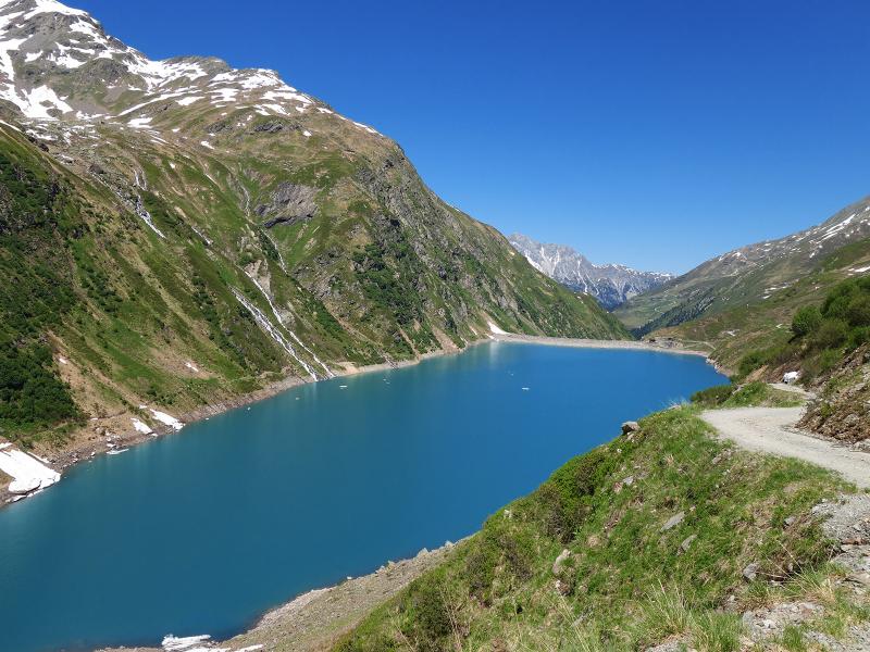
We walk uphill through the green valley, on the path with gravel surface. We pass by the Rossfall Alp (possibility to stop for a refreshment) and reach the dam of Lake Kartellspeicher. The turquoise blue water of this artificial lake reflects the surrounding mountain peaks. From here it is still about 2.5 km to the Darmstadt Mountain Hut (Darmstädter Hütte), and the path rises more and more. After about 3.5 hours of walking we finally reach our destination and enjoy the dumplings at the hut, as well as the panorama of the valley and the surrounding mountains. Afterwards we return on the same path. It takes us almost 3 hours for the descent as well, as there is a final ascent of about 350 meters to the cable car mountain station at the end of the route. Important: Check the current timetable of the Rendlbahn Cable Car!
Author: AT
-
- Starting point:
- Rendlbahn mountain station (St. Anton am Arlberg)
-
- Overall time:
- 06:10 h
-
- Total route length:
- 18,4 km
-
- Altitude:
- from 1.698 m to 2.348 m
-
- Altitude difference:
- +1003 m | -1003 m
-
- Signposts:
- Darmstädter Hütte, no. 513
-
- Destination:
- Darmstädter Hütte Mountain Hut
-
- Resting points:
- Rossfall Alpe, Darmstädter Hütte
-
- Recommended time of year:
- Jan Feb Mar Apr May Jun Jul Aug Sep Oct Nov Dec
-
- Download GPX track:
- Hike to the Darmstädter Hütte mountain hut
If you want to do this hike, we suggest you to check the weather and trail conditions in advance and on site before setting out.