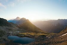
Short mountain hike with a perfect view on the Kalkkögel Mountains: The tour from the Kemater Mountain Hut to the Adolf Pichler Hut leads into the heart of the Stubai Alps
Image gallery: Hike to the Adolf-Pichler-Hütte mountain hut


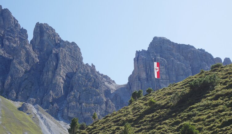
The Kalkkögel are by far not the highest peaks of the Stubai Alps, but the towers of dolomite rock are nevertheless among the most beautiful mountains in this area south of the Inn Valley. In order to reach the starting point of our hike to the Adolf Pichler Mountain Hut, which is located at the foot of this majestic mountain range, we drive from the village of Grinzens on the gravel road (chargeable) to the parking space of the Kemater Mountain Hut (Kemater Alm). There we start our hike. First the path leads steeply across the meadows above the hut, then it continues easier and we cross the Griesbach stream.
The ascent on the last section up to the mountain hut is mastered via serpentines. Tyrolean food and hospitality await us at the Adolf Pichler Hut (Adolf-Pichler-Hütte). Especially in the afternoon hours the view on the mountains is impressive. It is possible to turn this hike into a round trip by hiking over Mt- Sonntagsköpfl, a small elevation above the Senderstal valley. Several high-altitude hikes can also be made from the hut, e.g. to the Hoadlsattel (difficult) or to the Seejöchl, as well as medium to difficult hiking and climbing tours on the peaks of the Kalkkögel.
Author: AT
-
- Starting point:
- Kemater Mountain Hut (parking space, reachable via the Senderstal toll road)
-
- Overall time:
- 01:45 h
-
- Total route length:
- 4,2 km
-
- Altitude:
- from 1.655 m to 1.993 m
-
- Altitude difference:
- +338 m | -338 m
-
- Signposts:
- no. 117
-
- Destination:
- Adolf Pichler Hut
-
- Resting points:
- Adolf-Pichler-Hütte
-
- Recommended time of year:
- Jan Feb Mar Apr May Jun Jul Aug Sep Oct Nov Dec
-
- Download GPX track:
- Hike to the Adolf-Pichler-Hütte mountain hut
If you want to do this hike, we suggest you to check the weather and trail conditions in advance and on site before setting out.