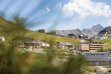
With the Sellraintal valley and Kühtai, located at 2,020 m a.s.l., this cross-country skiing area is absolutely snow-sure
INNSBRUCK AND SURROUNDINGS
Level of difficulty: easy
-
Birgitz Trail, Axams
distance: 4.5 km
technique: skating, classic -
SK4 Trail, Mieming
distance: 1.5 km
technique: skating, classic -
Neu-Götzens Trail, Natters
distance: 7.7 km
technique: skating, classic -
Aigling Trail, Oberperfuss
distance: 1.3 km
technique: skating, classic -
Kammerland Trail, Oberperfuss
distance: 0.7 km
technique: skating, classic -
Völsesgasse Trail, Oberperfuss
distance: 3.2 km
technique: skating, classic -
Holzleiten Lärchenwiesen no. 4 Trail, Obsteig
distance: 5.6 km
technique: classic -
Holzleiten Ü Training Track, Obsteig
distance: 2.0 km
technique: classic -
No. 1 Training Track, Obsteig
distance: 2.0 km
technique: classic -
St. Sigmund Trail, St. Sigmund im Sellrain
distance: 2.5 km
technique: skating, classic -
Gries im Sellrain Circuit, Sellrain
distance: 1.0 km (illuminated)
technique: skating, classic -
Tiroler Trail Lüsens, Sellrain
distance: 5.5 km
technique: skating, classic -
Lüsens Training Track, Sellrain
distance: 0.7 km
technique: skating, classic -
Affenhausen no. 2 Training Track, Wildermieming
distance: 1.5 km
technique: classic -
Rodelhügel no. 1 Training Track, Wildermieming
distance: 1.5 km
technique: skating, classic
Level of difficulty: medium
-
Claudia Trail, Kühtai
distance: 2.0 km
technique: skating, classic -
Maximilian Trail, Kühtai
distance: 2.6 km
technique: skating, classic -
SK2 Trail, Mieming
distance: 6.0 km
technique: skating, classic -
SK3 Trail, Mieming
distance: 4.5 km
technique: skating, classic -
V2 Connection Trail, Mieming
distance: 2.0 km
technique: classic -
SK1 Trail, Obsteig
distance: 8.0 km
technique: skating -
V1 Connection Trail, Obsteig
distance: 2.0 km
technique: classic -
Arzkasten no. 3 Trail, Obsteig
distance: 13 km
technique: classic -
Burkleite no. 6 Trail, Obsteig
distance: 8.0 km
technique: classic -
Gschwent no. 2 Trail, Obsteig
distance: 6.3 km
technique: classic -
Thal/Wald no. 5 Trail, Obsteig
distance: 4.6 km
technique: classic -
Golf Trail - Cross-country Centre, Rinn
distance: 5.5 km
technique: skating, classic -
Panorama Trail - Cross-country Centre, Rinn
distance: 9.5 km
technique: skating, classic -
Fernerboden Trail Lüsens, Sellrain
distance: 5.5 km
technique: skating, classic -
Lüsens Sports Trail, Sellrain
distance: 11 km
technique: skating, classic -
Gschwent no. 2 Trail, Wildermieming
distance: 6.0 km
technique: skating, classic -
Affenhausen no. 1 Trail, Wildermieming
distance: 4.5 km
technique: skating, classic
Level of difficulty: demanding
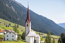
- Waterfall Trail Lüsens, St. Sigmund im Sellrain
distance: 0.8 km
technique: skating
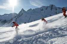
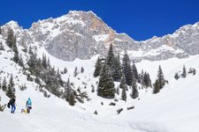
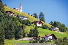
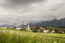
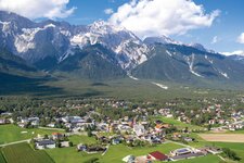
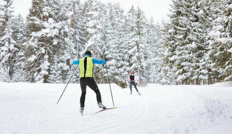
(in the picture cross-country skiing on the Mieming Plateau)
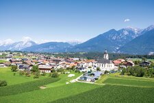
HALL - WATTENS AREA
Level of difficulty: easy
-
Gnadenwald Classic Trail, Gnadenwald
distance: 10 km
technique: classic -
Gnadenwald Skating Trail, Gnadenwald
distance: 6.4 km
technique: skating -
Tulfes Rinn - Panorama Trail 1, Tulfes
distance: 4.6 km
technique: skating, classic -
Tulfes Rinn - Panorama Trail 2, Tulfes
distance: 5.6 km
technique: skating, classic -
Golf Trail 1, Tulfes
distance: 2.9 km
technique: skating, classic
Level of difficulty: medium
- Tulfes Rinn - Panorama Trail 3, Tulfes
distance: 4.4 km
technique: skating, classic
Level of difficulty: demanding
- Golf Trail 2, Tulfes
distance: 5.8 km
technique: skating, classic
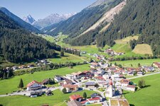
SEEFELD AREA
Level of difficulty: easy
-
A1 Night Trail, Seefeld in Tirol
distance: 3.0 km (illuminated till 8 pm)
technique: skating, classic -
A2 Lenerwiese Trail, Seefeld in Tirol
distance: 1.3 km (dogs allowed)
technique: skating, classic -
A3 Torfstisch Trail, Seefeld in Tirol
distance: 1.8 km
technique: skating, classic -
A4 Muggenmoos Trail, Leutasch
distance: 1.5 km
technique: skating, classic -
A5 Obern Trail, Leutasch
distance: 5.3 km
technique: skating, classic -
A6 Alpenbad Trail, Leutasch
distance: 5.6 km
technique: skating, classic -
A7 Gasse Trail, Leutasch
distance: 4.7 km
technique: skating, classic -
A8 Lehner Trail, Leutasch
distance: 1.9 km
technique: skating, classic -
A9 Unterleutasch Trail, Leutasch
distance: 13.7 km
technique: skating, classic -
A10 Weidach Trail, Leutasch
distance: 1.7 km
technique: skating, classic -
A11 Bodenalm Trail, Scharnitz
distance: 6.8 km
technique: skating, classic -
A12 Scharnitz Trail, Scharnitz
distance: 7.2 km
technique: skating, classic -
A13 Scharnitz Classic Trail, Scharnitz
distance: 2.0 km
technique: classic -
A14 Bärenwirt Trail, Leutasch
distance: 1.2 km
technique: skating, classic -
Snowfarming Trail, Leutasch
distance: 1.6 km
technique: skating, classic
Level of difficulty: medium
-
B1 Mösern Trail, Seefeld in Tirol
distance: 3.0 km (artificial snow-making)
technique: skating, classic -
B2 Auland Trail, Seefeld in Tirol
distance: 5.3 km
technique: classic -
B3 Lake Wildmoos Trail, Seefeld in Tirol
distance: 2.9 km
technique: skating, classic -
B4 Skating Centre Trail, Leutasch
distance: 1.2 km
technique: skating, classic -
B5 Katzenloch Trail, Leutasch
distance: 5.0 km
technique: classic -
B6 Interalpen Zubringer East Trail, Buchen-Mösern
distance: 0.5 km
technique: skating, classic -
B7 Panorama Trail, Leutasch
distance: 2.4 km
technique: classic -
B8 Interalpen Zubringer West Trail, Seefeld in Tirol
distance: 0.4 km
technique: skating, classic -
B9 Triendlsäge Trail, Seefeld in Tirol
distance: 3.0 km
technique: classic -
B11 Forest Trail, Leutasch
distance: 2.7 km
technique: skating, classic -
B12 Mösern Centre Trail, Mösern
distance: 1.0 km
technique: skating, classic -
B13 Lake Lottensee - Lake Mösern Trail, Mösern
distance: 4.6 km
technique: skating, classic
Level of difficulty: demanding
-
C1 World Cup Trail 2019, Seefeld in Tirol
distance: 8.4 km
technique: skating, classic -
C2 Wildmoos Trail, Seefeld in Tirol
distance: 4.8 km
technique: skating, classic -
C3 Neuleutasch Trail, Leutasch
distance: 5.1 km
technique: skating, classic -
C4 Katzenkopf Trail, Leutasch
distance: 2.7 km
technique: classic -
C5 Kaserwald Trail, Seefeld in Tirol
distance: 1.9 km
technique: classic -
C6 Buchen Trail, Wildmoos
distance: 3.1 km
technique: skating, classic -
C7 Bichlwald Trail, Leutasch
distance: 3.1 km
technique: skating, classic -
C8 Rauthgatter Trail, Seefeld in Tirol
distance: 1.5 km
technique: skating, classic -
C9 Plaik Trail, Leutasch
distance: 8.7 km
technique: skating, classic -
C10 Mundeknie Trail, Leutasch
distance: 2.5 km
technique: skating, classic -
C11 Lake Lottensee Trail, Wildmoos
distance: 3.4 km
technique: skating, classic -
Kaiser Max Circuit
Seekirchl Chapel - Leutaschtal valley - Seefeld in Tirol
distance: 59 km
technique: skating, classic -
Katzenkopf Circuit
Leutasch - Katzenkopf Mountain Hut - Leutasch
distance: 21.5 km
technique: skating, classic -
Wildmoos Circuit
Seekirchl Chapel - Wildmoos plateau - Seefeld in Tirol
technique: skating, classic