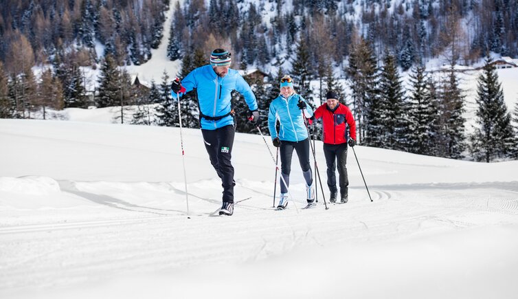
The region offers a 143 km cross-country ski network in the Oetztal, 70.5 km in the Pitztal and other beautiful ones in the Imst area
PITZTAL VALLEY
Level of difficulty: easy
-
Naturparkhaus Kaunergrat Training Track
distance: 0.6 km
technique: skating, classic -
Galtwiesen Trail, Arzl im Pitztal
distance: 2.6 km
technique: skating, classic -
Fischteich Trail, Jerzens
distance: 3.2 km
technique: skating, classic -
Glacier high-altitude track, Pitztal Glacier
distance: 5.2 km (at 2,700 m a.s.l.)
technique: skating, classic -
High-altitude track, Rifflsee
distance: 5.0 km (auf 2,250 m a.s.l.)
technique: skating, classic -
Boden Circuit, St. Leonhard im Pitztal
distance: 1.3 km
technique: skating, classic -
Kitzgarten Circuit, St. Leonhard im Pitztal
distance: 5.5 km
technique: skating, classic -
Neururer Circuit, St. Leonhard im Pitztal
distance: 9.5 km
technique: skating, classic -
Scheibrand Circuit, St. Leonhard im Pitztal
distance: 4.7 km
technique: skating, classic -
Stillebach Circuit, St. Leonhard im Pitztal
distance: 5.3 km
technique: skating, classic -
Training Circuit, St. Leonhard im Pitztal
distance: 1.5 km
technique: skating, classic -
Waterfall Circuit, St. Leonhard im Pitztal
distance: 3.6 km
technique: skating, classic -
Talschluss Circuit, St. Leonhard im Pitztal
distance: 2.7 km
technique: skating, classic -
Bärenbad Trail, Wenns
distance: 6.8 km
technique: skating -
Hubertus Trail, Wenns
distance: 7.5 km
technique: skating
Level of difficulty: medium
- Valley Trail, St. Leonhard im Pitztal
distance: 21.3 km
technique: skating, classic
IMST AREA
Level of difficulty: easy
-
Gurgltal Trail, Imst
distance: 18.8 km
technique: skating, classic -
Hoch-Imst Trail, Imst
distance: 2.0 km (artificial snow-making on 1.5 km)
technique: skating, classic -
Teilwiesen Trail, Imst
distance: 7.0 km
technique: skating, classic -
"Sonnenloipe" trail, Nassereith
distance: 3.8 km
technique: skating, classic -
Rossbach Trail, Nassereith
distance: 1.1 km
technique: skating, classic -
Kloster Trail, Nassereith
distance: 1.0 km
technique: skating, classic -
Greit Trail, Nassereith
distance: 2.4 km
technique: skating, classic -
Moos Circuit, Nassereith
distance: 2.1 km
technique: skating
OETZTAL VALLEY
Level of difficulty: easy
-
Oberrieder Circuit, Längenfeld
distance: 2.4 km
technique: skating, classic -
Längenfeld - Au Circuit, Längenfeld
distance: 3.6 km
technique: skating -
Au Trail, Längenfeld
distance: 1.5 km
technique: skating, classic -
Night Trail, Längenfeld
distance: 3.0 km (illuminated)
technique: classic -
Lehen Trail, Lehen
distance: 0.7 km
technique: skating, classic -
Tellerboden Night Trail, Lehen
distance: 1.3 km (illuminated)
technique: skating, classic -
Hochgurgl high-altitude track, Obergurgl-Hochgurgl
distance: 0.8 km
technique: skating, classic -
Hochgurgl Training Track, Obergurgl-Hochgurgl
distance: 0.4 km
technique: skating, classic -
Obergurgl Training Track, Obergurgl-Hochgurgl
distance: 0.5 km
technique: skating, classic -
Hofer Böden/Windau Trail, Sölden
distance: 1.9 km
technique: skating, classic -
Untersölden Trail, Sölden
distance: 4.1 km
technique: classic -
Sonnenplateau Trail Niederthai, Umhausen
distance: 3.0 km
technique: skating, classic -
Ötzi Village Trail, Umhausen
distance: 1.0 km (Mondays, Wednesdays, Fridays illuminated)
technique: skating, classic -
Training Track, Vent
distance: 1.0 km
technique: skating, classic -
Ebenle Trail, Vent
distance: 1.0 km
technique: skating, classic
Level of difficulty: medium
-
Ochsengarten Trail, Haiming
distance: 2.7 km
technique: skating, classic -
Gries high-altitude track skating, Längenfeld
distance: 6.1 km
technique: skating -
Gries high-altitude track classic, Längenfeld
distance: 8.2 km
technique: classic -
South Trail skating, Längenfeld
distance: 10.6 km
technique: skating -
North Trail, Längenfeld
distance: 7.9 km
technique: classic -
South Trail classic, Längenfeld
distance: 9.7 km
technique: classic -
Night Trail, Längenfeld
distance: 3.3 km (illuminated)
technique: skating -
Matau Connection Trail, Lehen
distance: 1.0 km
technique: classic -
Pill - Angern Trail, Obergurgl-Hochgurgl
distance: 5.3 km
technique: skating, classic -
Zwieselstein Trail, Sölden
distance: 5.5 km
technique: skating, classic -
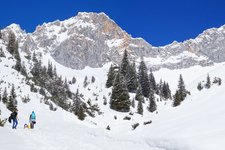
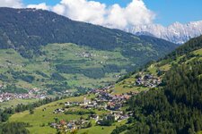
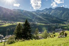
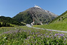
Früh Trail Niederthai, Umhausen (in the picture)
distance: 1.1 km
technique: skating, classic -
Horlachtal Trail, Umhausen
distance: 3.3 km
technique: skating, classic -
Matau Trail, Umhausen
distance: 2.1 km
technique: skating, classic -
Stuiben Waterfall Trail, Umhausen
distance: 5.0 km
technique: skating
Level of difficulty: demanding
- Tauferberg Trail, Umhausen
distance: 2.3 km
technique: skating, classic