At Karrösten there is the highest located sweet chestnut of North Tyrol, a natural monument since the Sixties
Image gallery: Karrösten


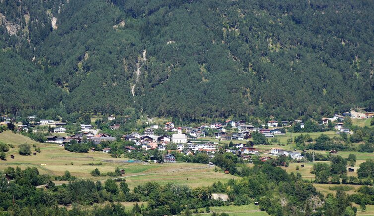
Altitude: 918 m a.s.l.
Karrösten is located on the south west slope of Mt. Tschirgant, at the junction of the Gurgltal and Inntal valleys. Together with the hamlets Brennbichl and Königskapelle, the main village forms the municipal area. Already in Bronze Age, people started mining in this sunny area, a business that flourished in the 16th century. Today, above all fruits and corn are cultivated on the slopes.
Karrösten is known for its Geologic Trail, a hike which takes you through 30 million years of the earth's history. To clarify, once upon a time the village was often threatened by natural catastrophes, which makes researchers assume that the village in its present state was built on the remnants of an ancient one. It takes you about 2 hours to walk this theme trail, snaking high above Karrösten upwards to the Karrösten Mountain Hut at 1,467 m a.s.l. Also with bad weather you can spend active holidays: The Karrösten Boulder Hall is a popular meeting point.
If you are rather interested in culture, we recommend you to visit the King's Chapel known as Königskapelle. Inaugurated in 1855, it reminds on the Emperor Frederick Augustus II of Saxony, who had an accident behind Imst when he made a trip into the Pitztal valley in 1854. His horse carriage tumbled over and a horse badly injured him at the back of the head. On August 9, 1854, he succumbed to his injuries in the Neuner inn, where still today his death chamber is preserved. In the following year, his widow Duchess Marie Elisabeth of Saxony had the chapel built.


.jpg)


